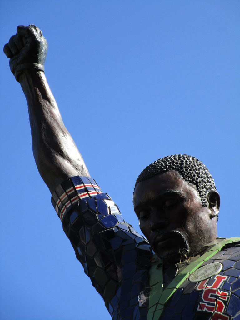
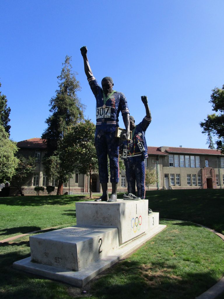
A famous scene took place at the 1968 Olympics. At the podium, two medalists put on a black glove each, took off their shoes showing black socks, wore several symbolic items, and raised one hand each during the playing of the national anthem. The third athlete on the podium, an Australian who placed 2nd, also wore a human rights badge, matching those worn by the two Americans, in solidarity.
There is a lot that can be said about this moment. (You can get a start on it here: https://en.wikipedia.org/wiki/1968_Olympics_Black_Power_salute). The two black athlete Olympians, who stood with their hands raised during the anthem as a protest to unequal treatment of people, were students at San Jose State University. They were Tommie Smith who had just set a world record and won gold in the 200m race and John Carlos who had won the bronze medal. Peter Norman was the silver medal winner from Australia who stood in solidarity with them.
Today, at SJSU, you are invited to stand with these historic SJSU alumni on the podium in the spot where a supporter once stood with them before the world.
It is a powerful statue if you take it in. It is a powerful moment if you accept the invitation and stand with them on the podium. It is an impressive work of art. It is an impressive social stand that these men took. It came with great costs for all three athletes. It came with rewards too; rewards in thoughts, awareness, conversations, and changes for others that will affect generations.
Today, you can take your stand in the middle of San Jose State University.
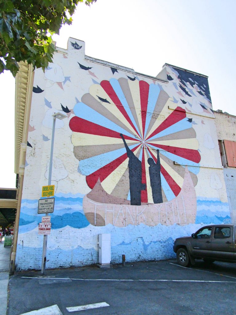
This piece of art helps put into context another piece of art that can be found near by at the gas station on 4th street. It reads: “Thank You.”
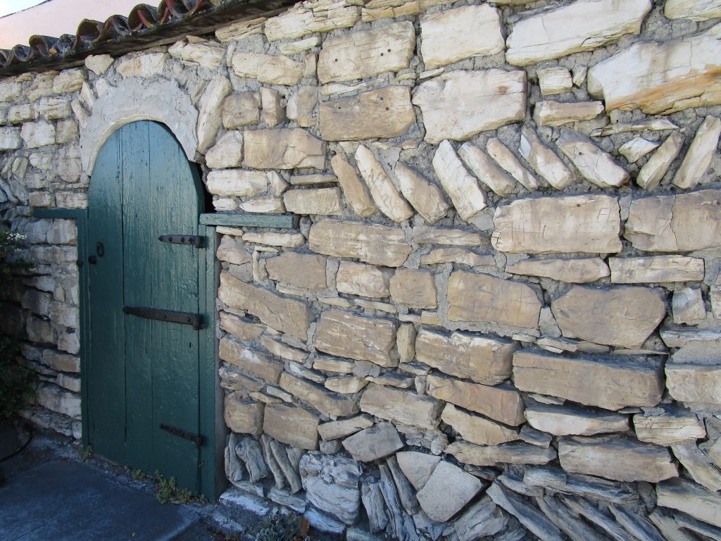
Property entrance built in 1832 across the street from Friendly Plaza.
Monterey is a little over an hour by car and well worth the drive, which is itself a pleasure. For those interested in San Jose history, it is impossible not to get excited about several of our nearby cities that are as wound up in the history of California.
Monterey is one of those important cities in our California history. Like San Jose, this is a city that one could spend a lifetime visiting, learning about, and photographing with great satisfaction.
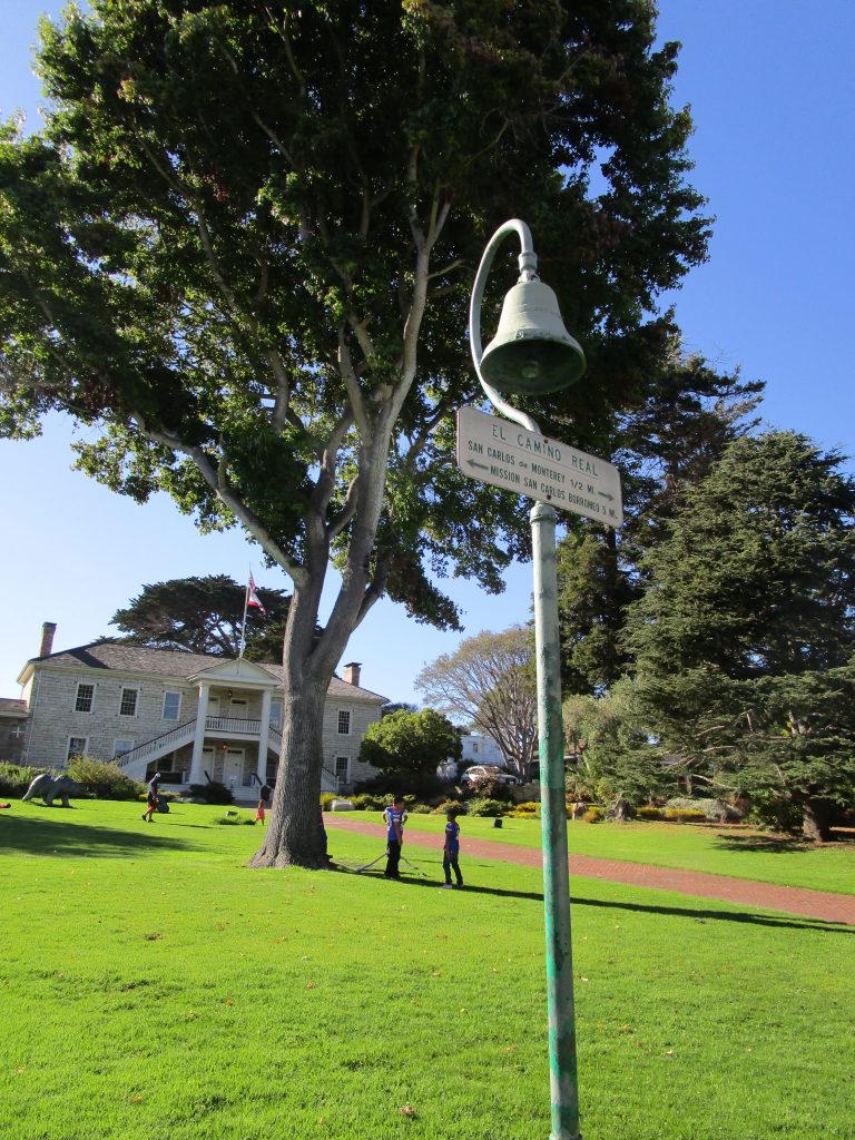
Colton Hall.
Pictured above is Colton Hall in the Friendly Plaza. In this building the California Constitution was written in 1849. It stated that San Jose would be the state capitol, was written in English and Spanish as a bilingual constitution, and led to California becaming the 31st state in 1850.
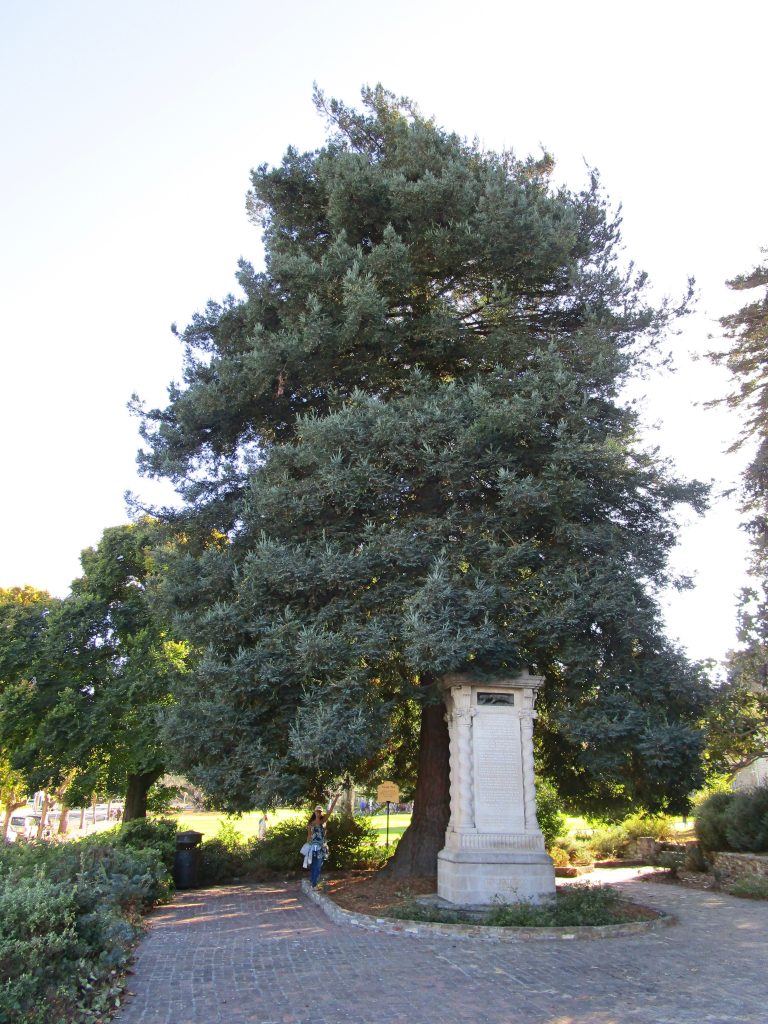
Moon Tree in Friendly Plaza.
500 seeds comprising four species of trees were sent in orbit around the moon with Apollo 14 in 1971. When they returned, some of what became known as Moon Trees were planted alongside similar trees for research, some were given to states or countries as gifts. In 1976, many were given to cities and states with appropriate climates for the various tree seedlings in order to celebrate the bicentennial of the USA. The Moon Tree pictured above is one of these 1976 trees. In the bay area, the nearest two Moon Trees are in Monterey and in Berkeley. For comparison of two very different earth species, the human species woman visiting the Monterey Moon Tree in the photo above was born in 1976 when the Coast Redwood species Moon Tree next to her was planted.
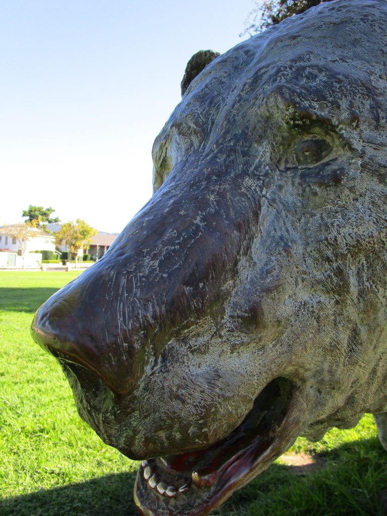
Bear statue in Friendly Plaza.
One interesting thing about bronze statues is that you can always tell where people are drawn to touch them most by the clearing of any natural tarnishing. For this bear, it is clearly the teeth that people are drawn to touch. It took my youngest child all of seconds before placing a foot in the bear’s teeth and asking me to take a picture.
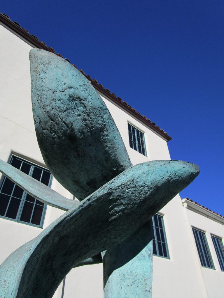
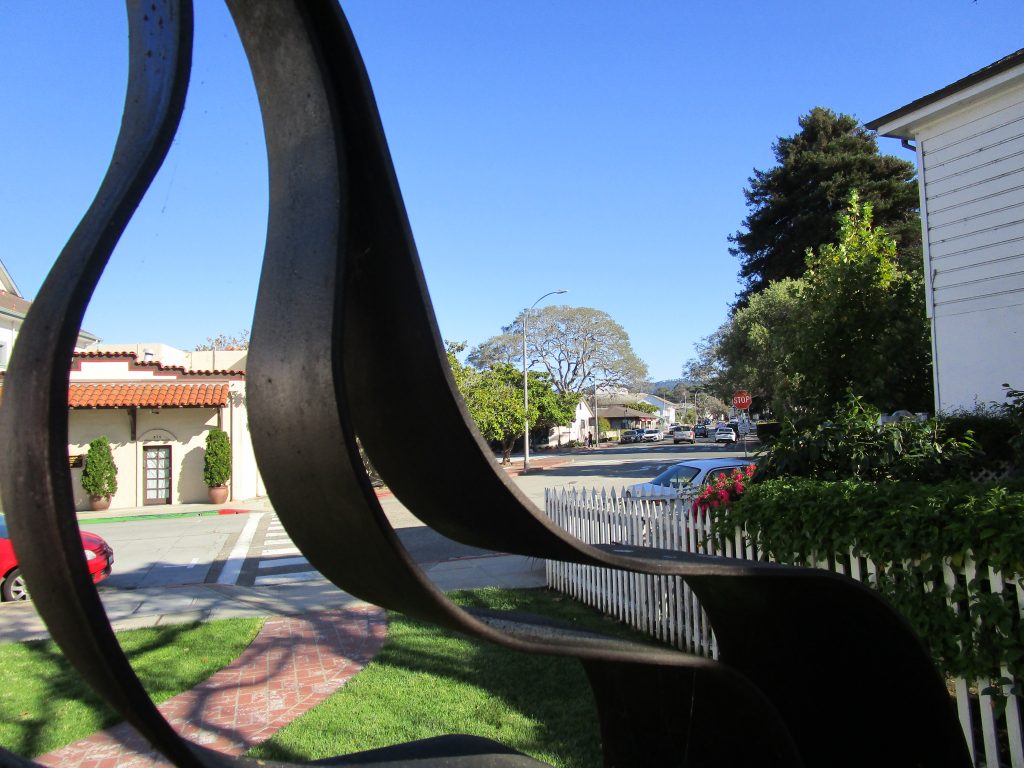
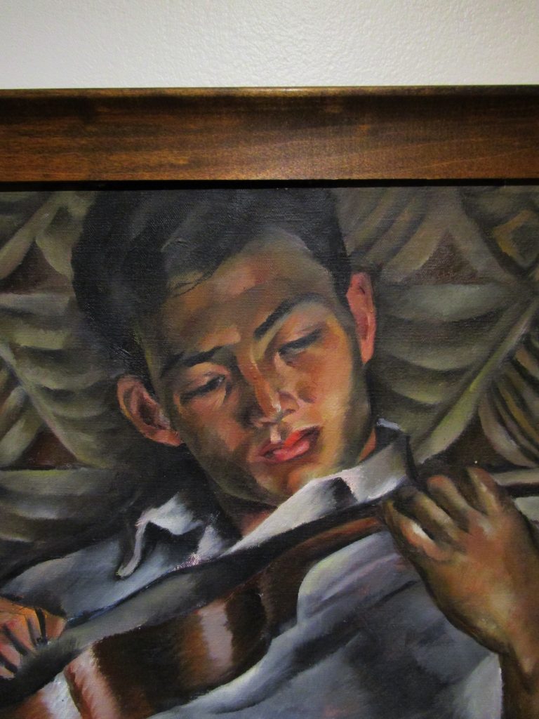
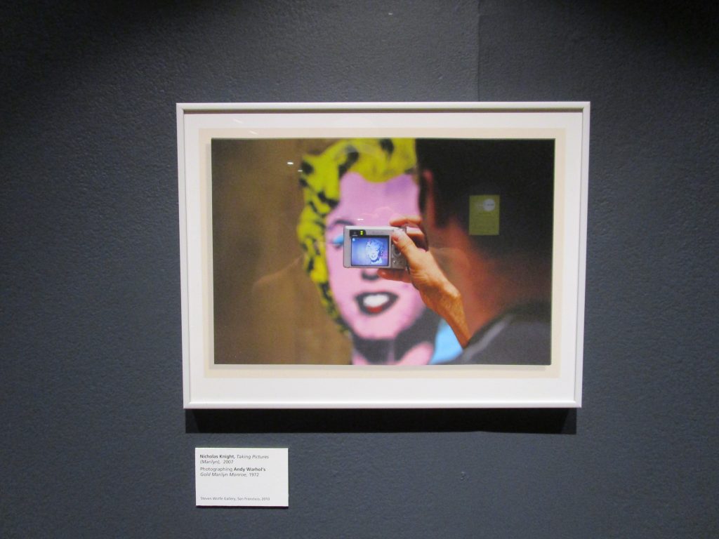
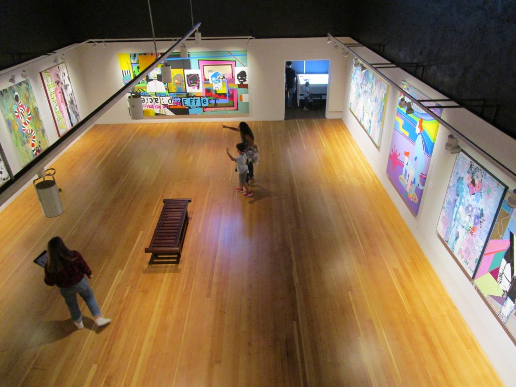
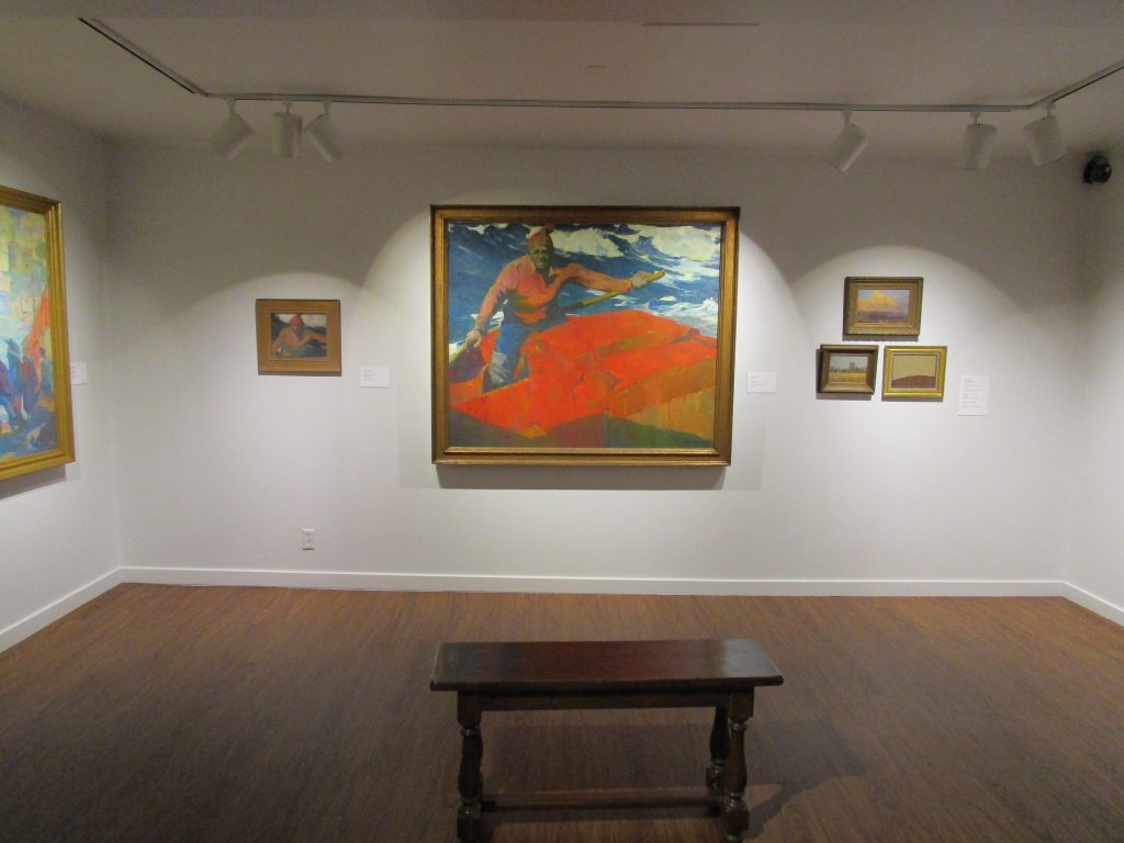
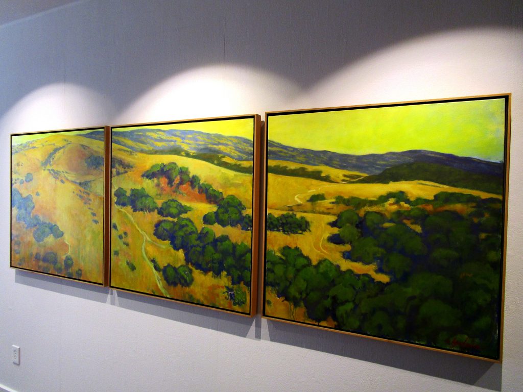
Across the street from the Friendly Plaza is the Montery Museum of Art. Below are a few of the treasures located there.
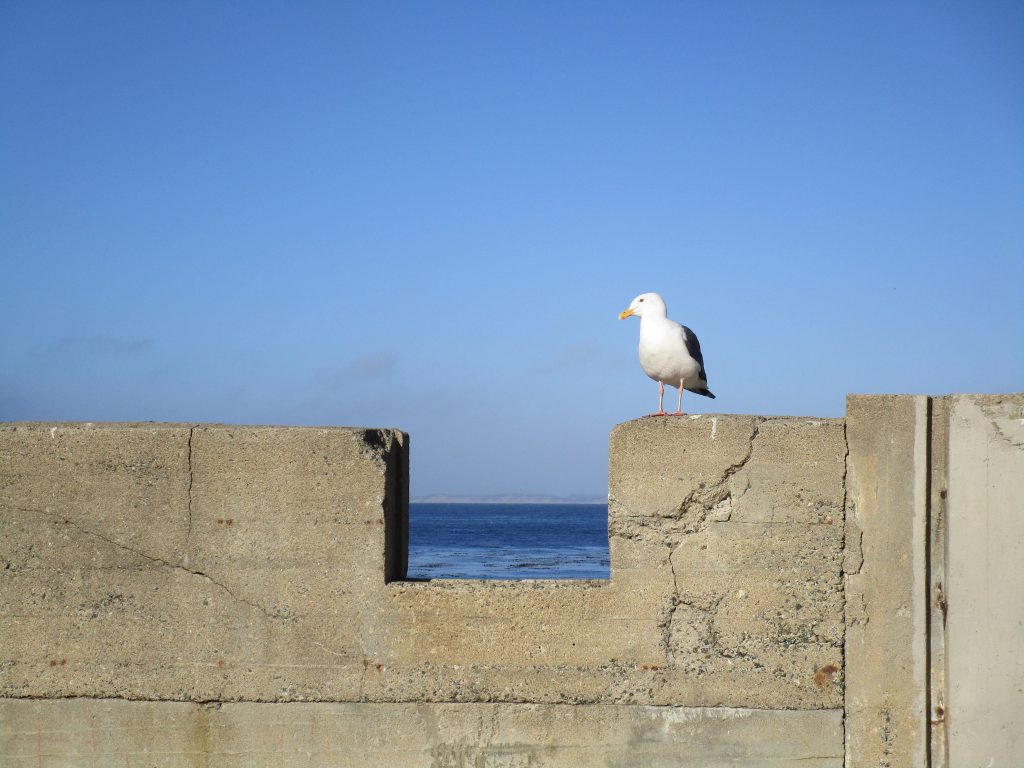
Monterey and Monterey Bay are incredible locations for discovery. The factors that brought people here for thousands of years continue to influence the lives of the people and continue to draw me to learn and discover more with great appreciation.
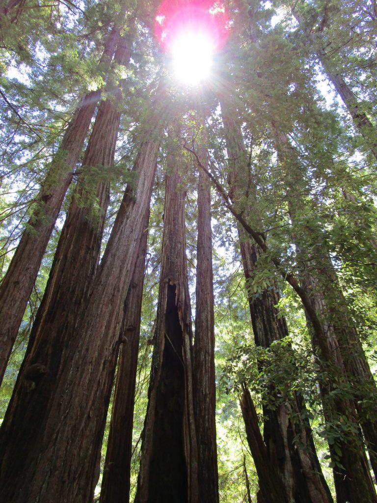
The first California State Park, it opened in 1902 to protect old growth forest in the Santa Cruz Mountains. In the beginning it was known as California Redwood Park and changed its name to Big Basin Redwoods State Park a few decades later.
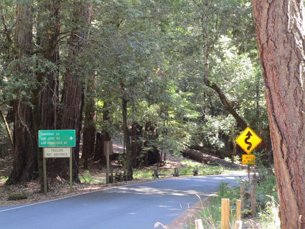
About 20 miles from San Jose through the air, the beautiful winding roads make it about 34 miles of great driving.
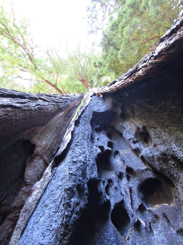
Many of the old growth redwood trees here are over 1,000 years old. Wow!
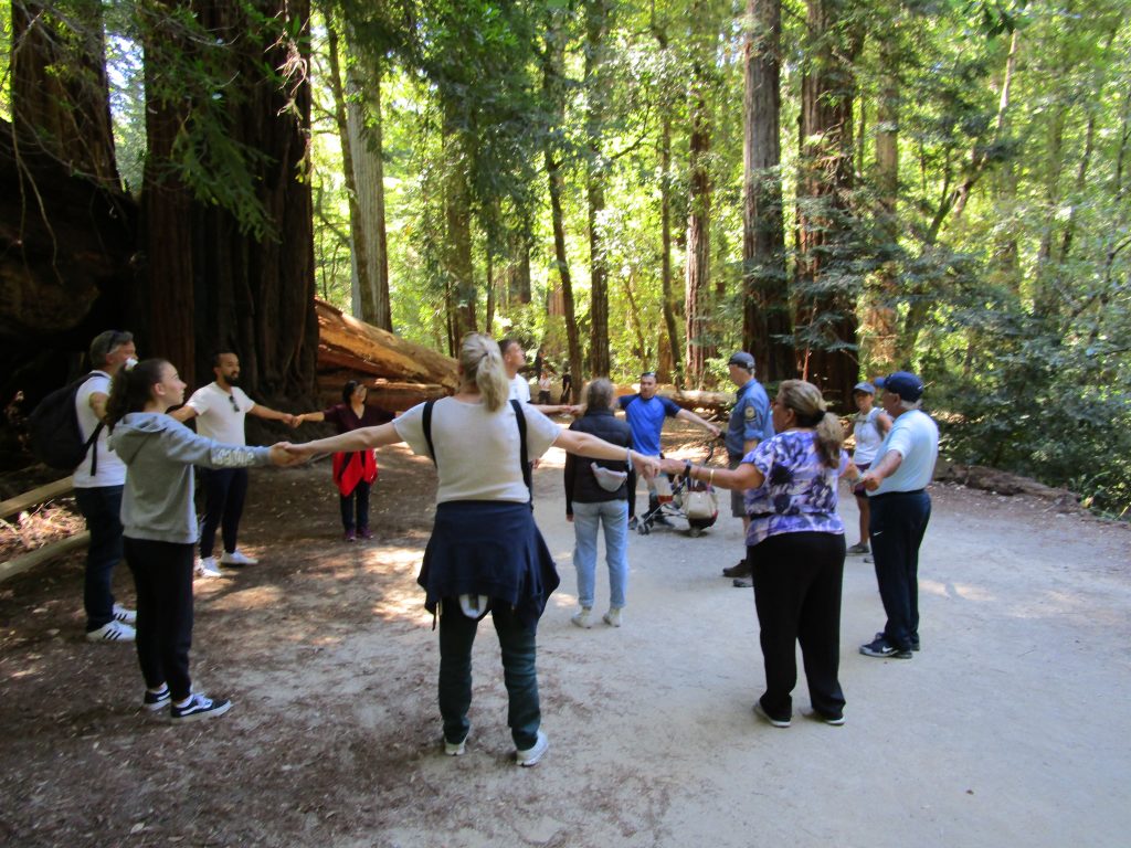
That tall tree in the center of the photo, out in the sun, is believed to be about 2,000 years old. So, it was there close to year 0.Local resident and docent Barry led a tour. Here on a trail a group of 12 at arms length estimate the circumference of one of the older trees in the park.
Much of the credit for the creation of the first California State Park goes to a San Jose photographer named Andrew P. Hill. All of these years I had heard of Andrew Hill high school in San Jose and never thought to ask who he was. Now I know. Andrew Hill was amazed at the sight of the old redwood trees, tallest trees on earth and able to live over 2,000 years. Through his photography and connections, he supported the preservation of these special forests. He led excursions of influential people to the trees that led to the funding and legislation that secured our first state park. Today, there is approximately 3% of the old growth redwood forests remaining in California and most of that is now on protected state public lands.
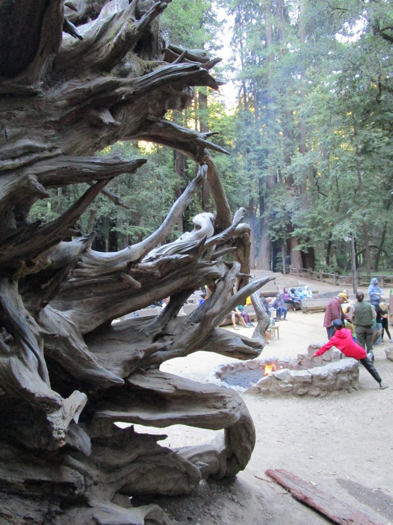
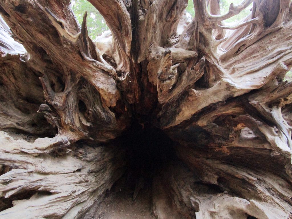
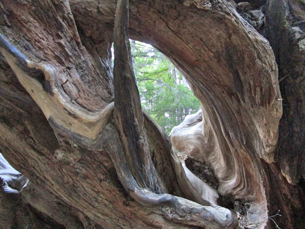
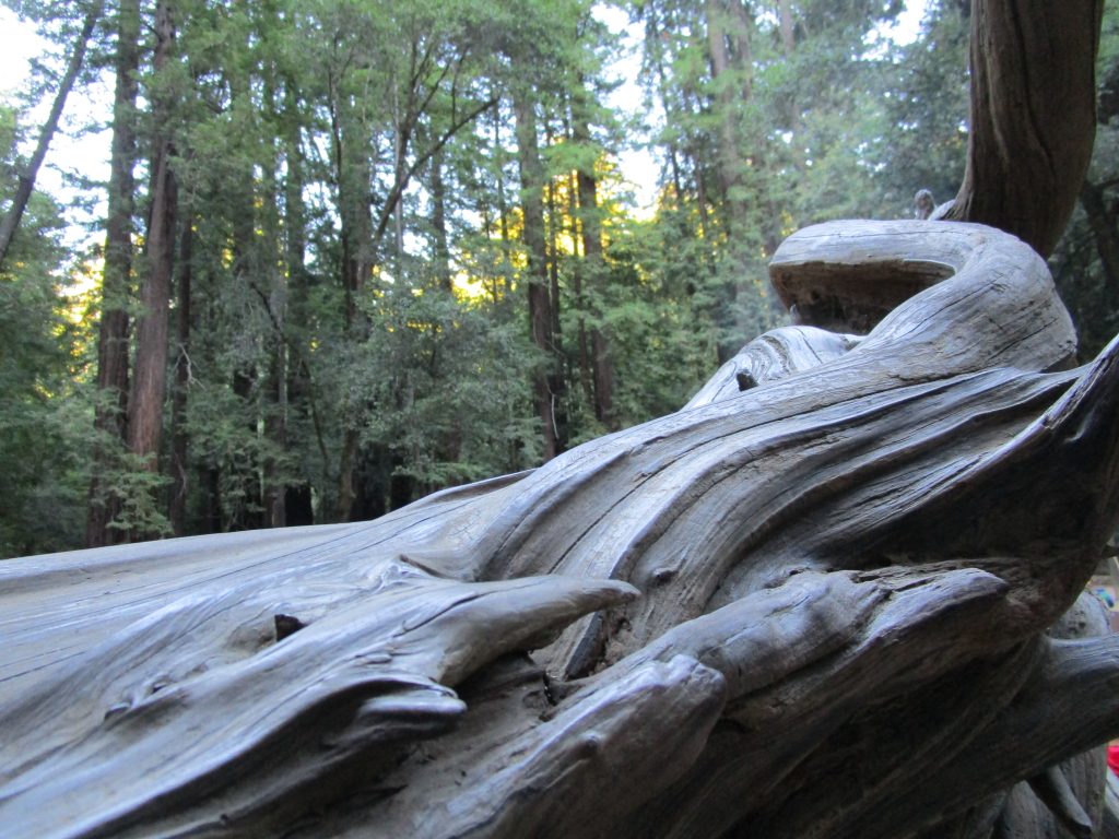
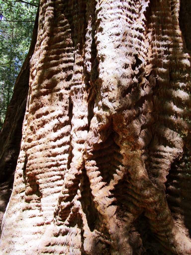
Ranger programs and marshmallows.The roots of a fallen redwood tree.The redwood trees are well suited to live through years, storms, fires, and more. This redwood tree, and a few of its clones and relatives nearby, has a genetic mutation that gives its bark this wavy shape.
The park is beautiful. The trees are beautiful. The guided walk we went on added so much to the entire experience. I found myself trying to identify trees afterwards and seeing new things around me as I contemplated the life cycles of the rain forest. Also cool, I now know what a huckleberry is and what it tastes like.
Many people began playing with radio waves in the early 1900’s, but one man named Charles Herrold in San Jose was the first to set up a regularly scheduled broadcast forming the first radio station.
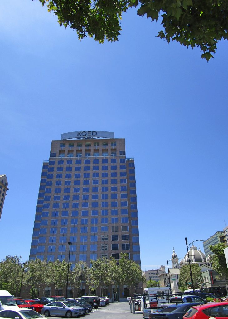
Where now stands the KQED building, right between the Fairmont Hotel, Cathedral Basiilica, San Jose Museum of Art, and Cesar Chavez Park, once stood a bank building from where Charles Herrold attached his antenna and began broadcasting his weekly radio show. He may even have coined the term broadcasting, a term taken from farming, when he was “broadcasting for the people San Jose.” On the show, he, his wife, and a friend, entertained with talk, stories, contests, and the reading of the newspaper.
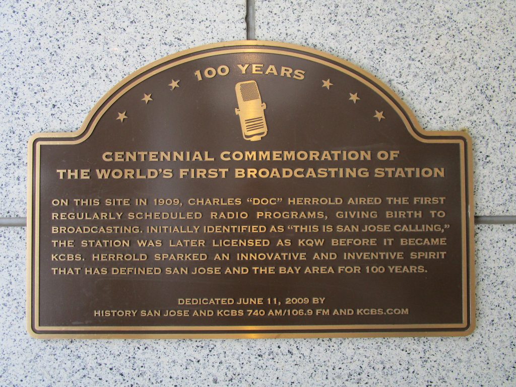
There are at least three plaques placed on the building now standing in the location of the world’s first radio station including the California State Historical Landmark plaque, the above pictured plaque commemorating 100 years, and one commemorating 50 years.
After the radio broadcasting act in 1921, Charles Herrold obtained a license and his station became radio station KQW. In an interesting circle of fate, CBS eventually purchased KQW and changed its call sign to KCBS in 1949. Then, in 2006, KCBS moved their San Jose news team into the building without at the time knowing the history of the location and how it related to the KCBS radio station’s early origins.
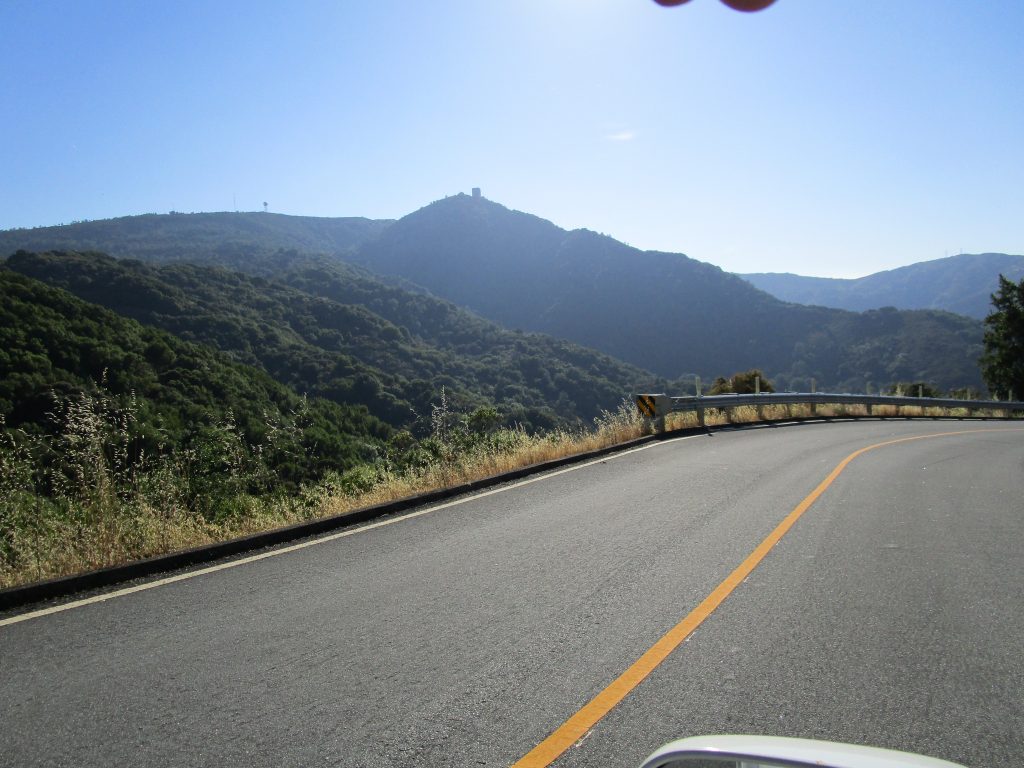
From just about everywhere in San Jose, there are a few orienting landmarks that can be seen. One of them is the square building, the box, atop Mt. Umunhum.
Getting closer to Mt. Umunhum on a winding and beautiful drive.
We listened to a fascinating app as we drove to the top. The app is designed for a self guided walking tour once there but it was perfect for us on the car drive as it lasted nearly the entire drive from our home, inspired us with thoughts of our destination, and gave us thoughts to consider as we explored the top.
Mt. Umunhum is a name that includes the root word for Hummingbird in all of the indigenous Ohlone dialects. The local natives named animals by the sounds that they made and Umunhum sounds like the moving wings of the hummingbird. And yes, I did see a hummingbird and butterflies; both of which apparently love this mountain top.
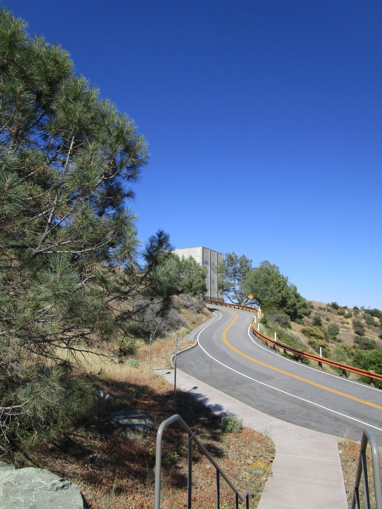
This was once Almaden Air Force Station, home to over one hundred military personnel and their families including many children. A small world complete with a bowling alley, pool, shops, and of course, the box that once held a state of the art long range radar dish atop it to detect aircraft from 250 miles away out over the ocean during the 60’s and 70’s until it was replaced by more advanced satellites. The one thing the station lacked was a school for the children who took a bus into San Jose each school day.
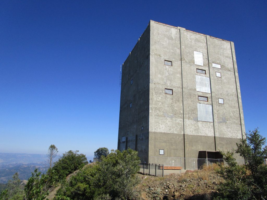
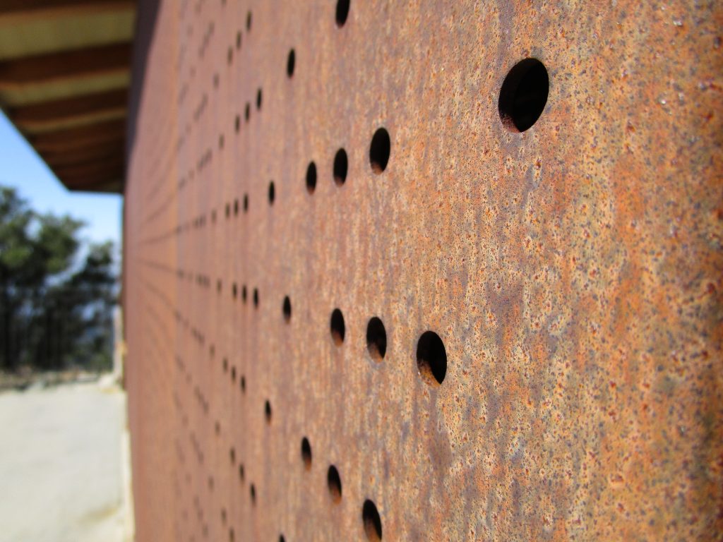
The box up close.
It was so interesting to see the box up close. I stared and argued with myself weather the box should be bigger or smaller in order to make it correct for the size it would appear after I drove the distance needed to get back home. That is, until I realized I had talked myself into a ridiculous conversation as I marveled at the structure and surroundings because obviously it was my perceptions that needed to be calibrated and not the size of the building to make all of the sizes and distances make sense with reality. It is often fun to run down mental rabbit holes.
Today, all of the buildings, except the iconic radar building, have been removed and work has been done, and continues, to restore the shape and vegetation of the mountain top. The renovations included bringing rock, previously pushed over the edges to build the station, back to the top and adding back 15 feet of altitude to the peak as it once had been.
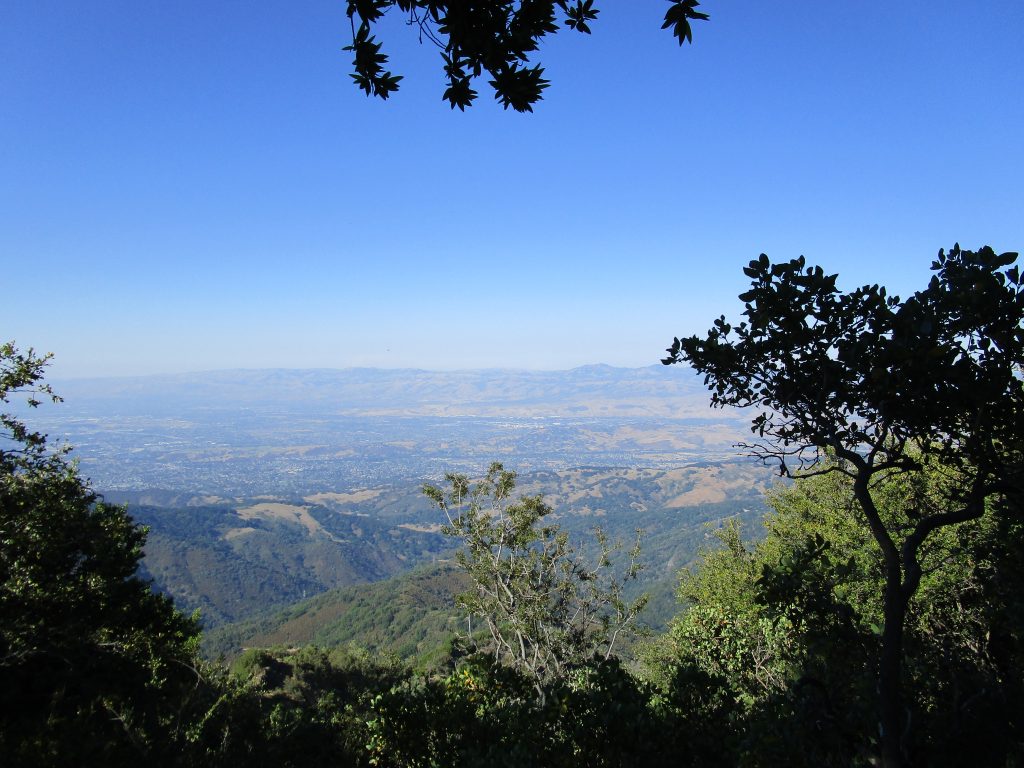
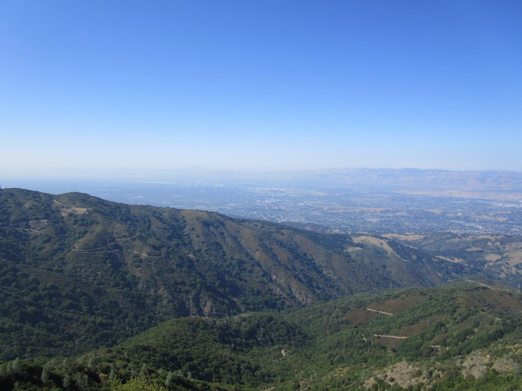
The views are, of course, incredible. It was a hazy day that we arrived and we could still see the San Francisco Bay as it reached San Jose, all of San Jose, the beaches of Santa Cruz at the ocean, Monterey across Monterey Bay, and so much more.
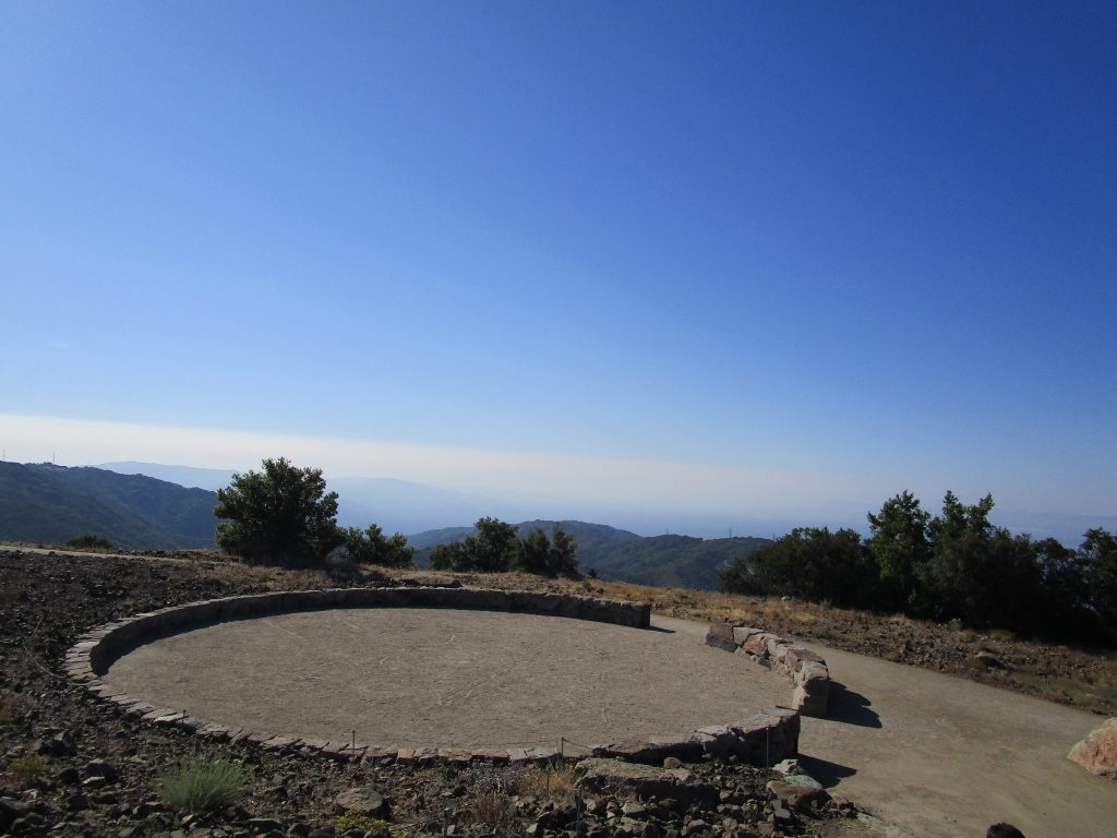
The descendants of the displaced native peoples of this land were consulted and asked that a prayer circle be built and opened to all of any faith to pray for ancestors and the future.
Prayer circle.
The prayer circle is opened to the east for native prayer rituals. The four directions are marked with iron. Using the iron marks as guides I found the exact middle to stand in. For no particular reason I did this and then I spoke, and… wow! My voice reverberated so beautifully. It was a shock and amazing. From the middle ones voice bounces harmonically off of the stone circle and comes back with a mellow and deepening vibration that was quite fun to play with. It reminded me of the childhood discovery of speaking into a fan. The excitement at the discovery and play at the effect only added to the pleasure of reflection from this beautiful point on the mountain.
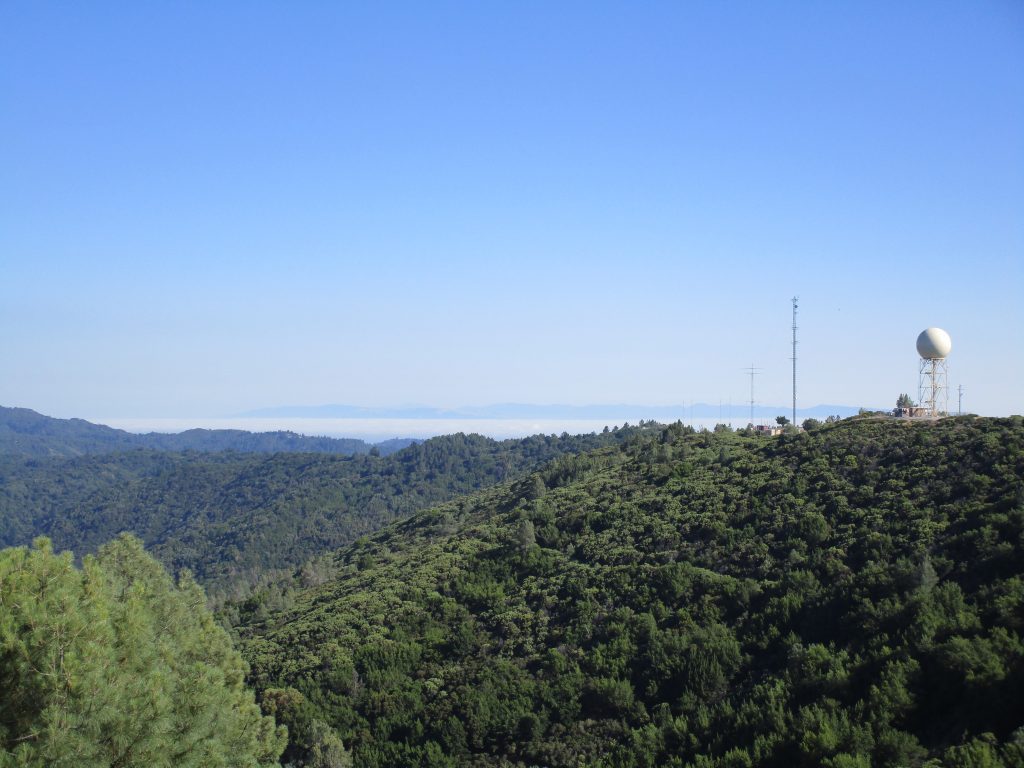
In the picture above, you can see the raised sphere nearby to the big box. The sphere is visible from some parts of San Jose depending on viewer’s location and weather. That sphere is a weather radar. When we watch the local news and see the green/yellow/red shapes moving in to indicate the degree of clouds and rain moving in to the bay, it is this radar and its siblings in the bay area that bring us those images.
Information building at Mt. Umunhum.A view from the top looking over San Jose.
The views, the perspective, the thoughts; these will bring me back to the top of Mt. Umunhum.
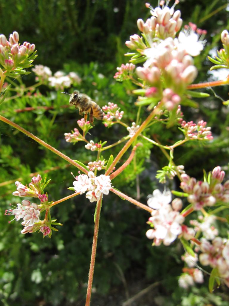
The bee’s wings so fast my camera could not catch them.
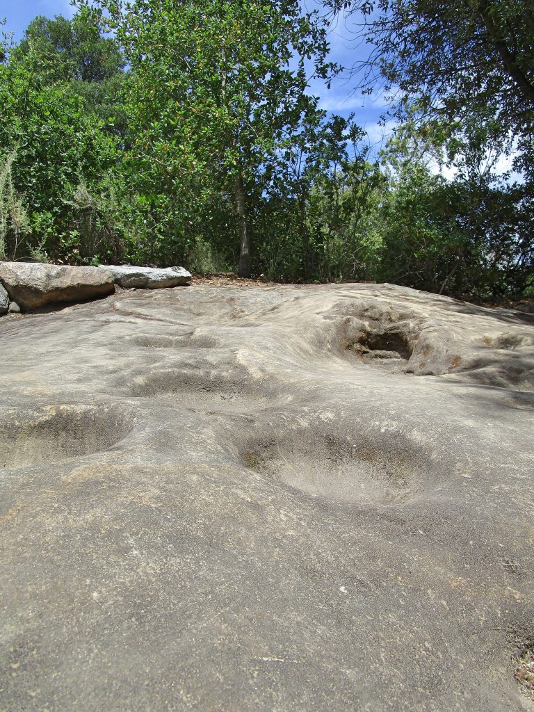
Chitactac-Adams county park is a remarkable place. For hundreds of years this was the home of Native peoples. We can say that about all of California. But here, you can touch…
Those, in the picture above, are mortars ground into the rock from hundreds of years ago, made by the people who lived here along the Uvas Creek, grinding food from the land around… and you can touch them! There are many of them and it is wonderful to imagine the many hours of their use, the people who were here before in the same space as I occupy now, leaning over these bowls in the rock, and touching history.
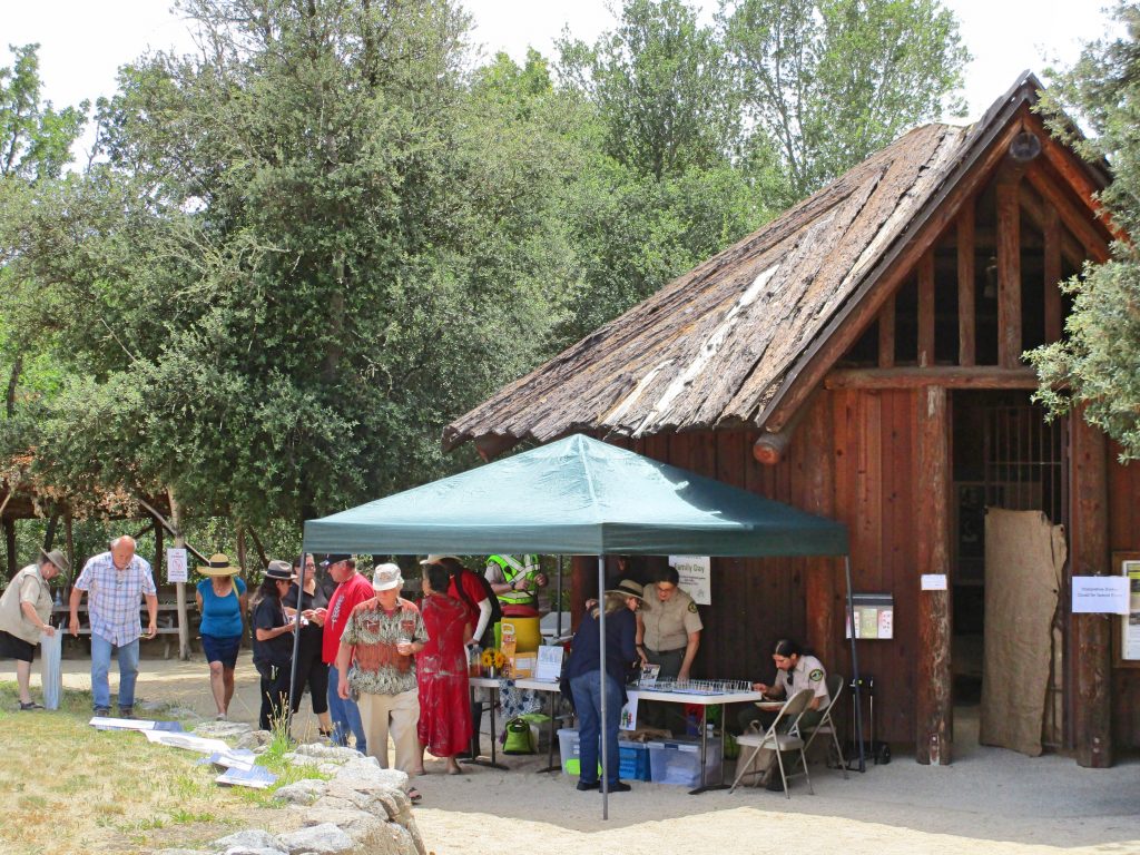
On the annual family day, you can do crafts, watch a Native American ceremony, play traditional games, and learn. My children loved making jewelry from pine nuts that they turned into beads by grinding off the two sides and cleaning out the hole through the center.
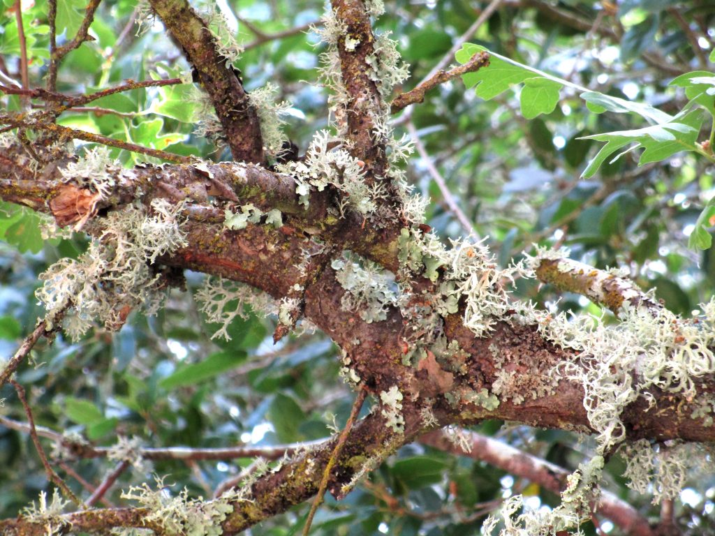
It is a beautiful place with so much nature to look at. Some of the branches are amazing, like lightning bolts, jerking horizontally through the air above. I try, but the pictures below don’t do the lightening branches justice, try and marvel at them in person if you get the chance.
Hundreds of years with people living here along the river (the Chitactac part of the park name), nearly 100 years with an old school house (the Adams part of the park name), and then the last hundred years, until the recent fences to protect the petroglyphs went up, as a favorite jumping-off-into-the-river point for the local children. Remnants of the rope swing can still be seen, and adults can still be found who will talk of their youth and jumping off the big rock into the creek.
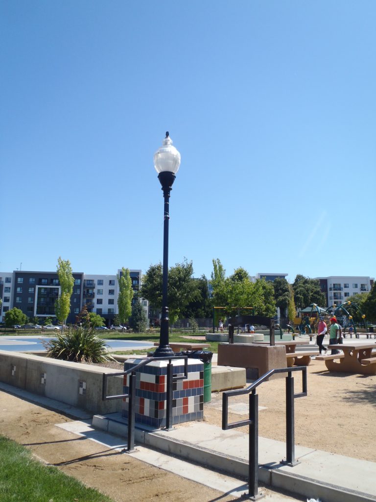
RAMAC Park is named after the first disk drive system. RAMAC stands for Random Access Method of Accounting and Control. It’s first level of development and invention occurred at the first California IBM laboratory in a rented building near the De Anza Hotel in San Jose. When the the new 190 acre IBM campus was ready on Cottle Ave., the lab moved to this south San Jose location and went on to innovate in big ways.
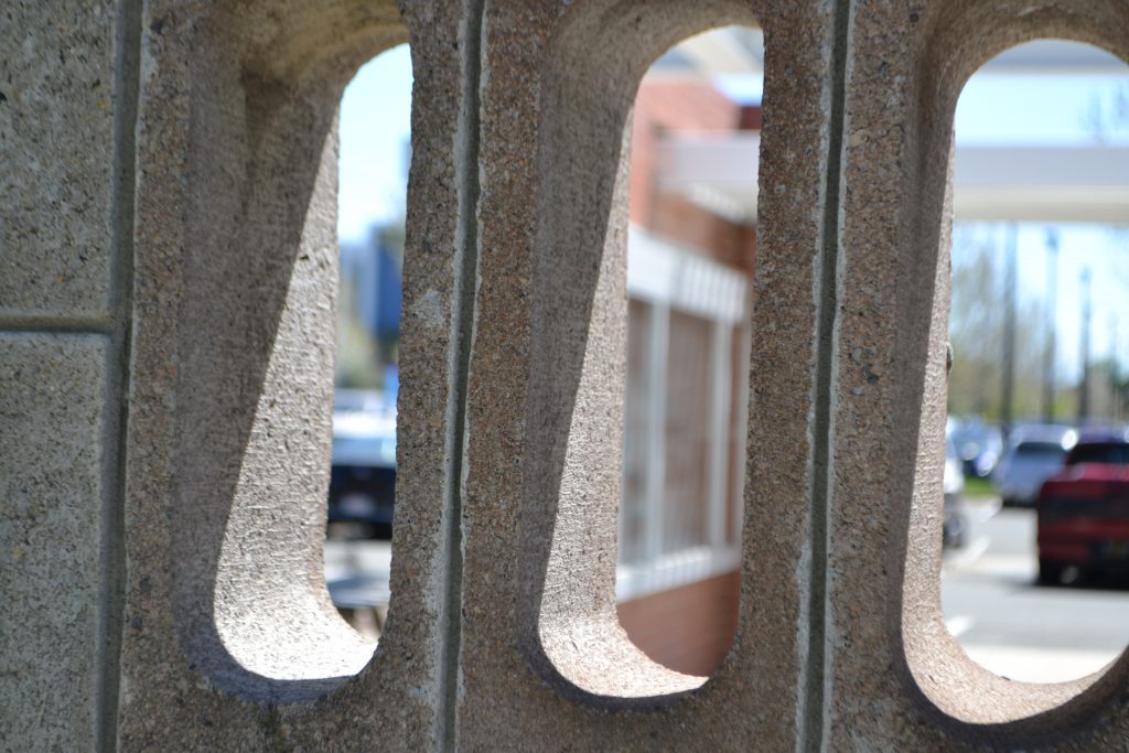
If you look around the park area today there is very little, but some, of the original tile mural work still up and visible. Other areas have covered the mural work to protect it, hopefully for a good and public purpose in the future.
A bit of the old tile mural, designed to symbolize the computer punch cards that originally played a role in bringing IBM out to San Jose, is visible past a security gate near RAMAC Park.
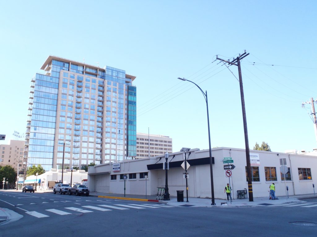
IBM came to San Jose in 1943 to establish its west coast operations and began printing punch cards for their computers near to where so much technology was being utilized. The first site was relatively close to San Pedro Square in downtown San Jose and the building they moved into still stands.
The low building in the foreground is the one IBM first rented in San Jose as their west coast headquarters before building out their custom campus in south San Jose.
Soon after, they moved to a large lot of land in south San Jose.
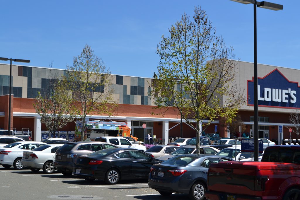
Building 25 Monument in the Lowe’s Parking Lot, south San Jose.
IBM became a part of the fabric of San Jose and the Silicon Valley. Here, among many creations, they invented the disk drive. Yeah, I know the time will come when that too will seem like ancient technology but for now its invention is still amazing to me and it is fascinating that it occured here in San Jose. The first disk drive was called the RAMAC, Random Access Method of Accounting and Control. And that explains why you will find a public park named after a computer system located in south San Jose; RAMAC Park. The park is within what became the second San Jose / West Coast headquarters of IBM. The first headquarters in downtown is where the RAMAC was conceived and work began, the second is where the disk drive was further developed and then greatly advanced.
Building 25 Monument in the Lowe’s Parking Lot, south San Jose.
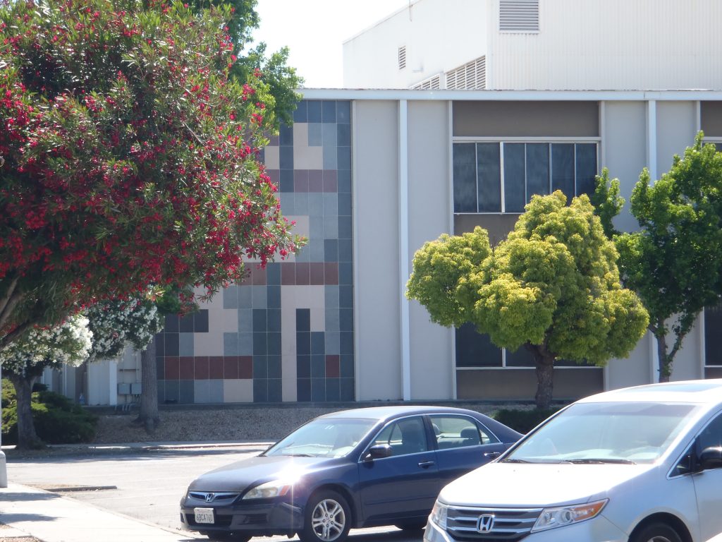
IBM invented a lot here in San Jose, and one thing was an idea. It was in south San Jose that they created a tech campus, an open university like place with large windows, art, large outdoor sculpture, water and ponds, bridges, and a cafeteria where all could eat right on campus. The place was designed to inspire conversation and to spark innovation throughout. It worked, and served as a model to others that we see in several silicon valley companies.
One of the artists hired during the campus construction and design was a muralist named Lucienne Bloch. She designed a tile motif for many of the buildings with alternating colors that was to reflect the idea of punch cards that had originally brought IBM to California and sparked so much new innovation.
The campus was eventually closed after the disk drive division of IBM was sold to Hitachi in the ’90’s.
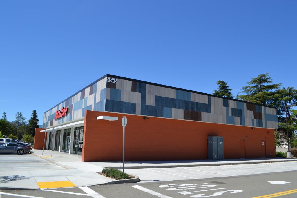
Today, the campus is gone and the land has been turned into homes, restaurants, shopping, and RAMAC Park. Not all memory was erased. There is a monument where Building 25 once stood, and the two buildings nearest wear a tiled pattern at their tops, designed to remind us of the important buildings that once stood there housing the minds and muscles of innovation, decorated in the muralist’s work, which was itself a hint at the punch card history that brought IBM to San Jose.
IBM and its innovative California culture is not gone from San Jose, though the prototype campus is gone. If you go for a nice hike in Santa Teresa County Park nearby, you may catch a glimpse of IBM’s Almaden Research facility, one of the few remaining corporate supported facilities for pure research. I think of it as a magical place where brilliant ideas come to life. It is a major contributor to the fact that IBM earns more patents annually than any other institution and has for decades. Work there has even led to a Nobel Prize. There is a lot that can happen when people share ideas and have a place that encourages them to explore and develop their ideas and thinking.
Do you remember when old cars use to have metal bumpers? Well, bumpers use to be chrome and I think the move to plastic painted bumpers, while aesthetically pleasing, accounts for the comparably low turnout of colorful bumper stickers on the road these days. My hypothesis is that humans love color and can’t help but try to fill it in where they can. And a plain chrome bumper is practically begging for a splash of color. When I was growing up in San Jose, one of the bumper stickers I would notice often was the bright yellow “The Mystery Spot” bumper sticker. I still see them from time to time, some brave souls sticking them to their painted bumpers and some crafty drivers affixing them like band-aids to their bumper’s scratches. More often these days, bumper stickers of all colors find themselves on the chrome like covers of laptops.. Laptops- the chrome bumpers of today, begging for a splash of color. Just realized that, hmm.
Well, despite seeing all those stickers for years and talking to friends who had been there, I had never, until a few days ago, actually gone to The Mystery Spot in Santa Cruz.
I am sooo glad that I finally went!
Okay, in simplest form, what you are overtly going to see at The Mystery Spot is a single small wooden building on a hill. I was made to understood from friends over the years that the deal with this place is supposed to be about some crazy energy vortex causing water to flow uphill and other weird things. And, of course, I knew it was some kind of trick optical illusion. But it was so much more than that. It would have to be for this pace to be an actual California Historical Landmark, Landmark #1055.
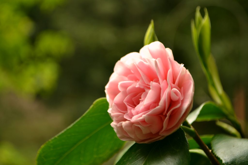
(Pretty flowers and giant trees surround as you wait for your tour to begin at The Mystery Spot.)
First impression upon arriving? Wow, these are friendly people. Really. The guy in the parking lot was the happiest and friendliest parking lot guide I could imagine, magnified by approximately 300%. As if I ever imagined there was such a job as a parking lot guide welcoming me as I drove passed and pointing out an open spot in the free parking lot with a smile. Then, as we walked into the place, we were greeted by… well, a greeter, with three badges declaring “Greeter” on his shirt and the friendliest of demeanors. Another guy sweeping up paused to chat and make me laugh and talk to my kids. What kind of happy-crazy-town is this?
Second impression? It only costs $8 to go in! What? I can not believe that a destination type place near us could only cost $8 to get into in the year 2019. Yes, I am about to see a small sideways wooden building and so charging $8 is theoretically about right when you consider restrooms, etc. provided out in the forest…but I assumed that nothing with such name recognition would have a reasonable cost. Shocked, is what I was! I mean, it costs $6 to park in most of our County Parks and they don’t have greeters walking around to make you smile. I’m not complaining, I love our County Parks and happily buy my annual parking pass every year. It’s just that I was impressed and surprised that any destination type visit could have a cost that has become less than most people would spend for a fast food meal.
Eventually, it was our turn for the tour. How would they do it, I wondered. Serious, perhaps, and explain the warp zone vortex what-cha-ma-call-it like a crazy cult follower? Or with a surly attitude, like a minimum-wage-paid teen in need of the money who knows they are supposed to sell some wacky story to a bunch of adults who should know better? Critically, maybe, like a scientist who drank the kool-aid? Well, it was none of the above. I should have known better after seeing so many friendly employees and the fact that this place has been around since decades before I was born.
The tour guide was young but there was no hint of a surly attitude or kool-aid induced craziness. No, he was simply funny! It turned out to be a performance after all and one that was welcomed and entertaining. How long did it take this place to perfect this art? The whole presentation was perfect. Perfectly funny with silly jokes, perfectly presented with quasi-possible story telling, and still perfectly sane in its silly delivery. I was again impressed.
And then, while I continued to just enjoy the show and wondered at the optical illusions before me, it was our turn to spend some time in the cabin. And that is when I experienced the best $8 worth of awesome I could have imagined. I became giddy like a child inside. How in the world could an illusion create so real a visceral response in me? It was AMAZING! I was consciously walking in an optical illusion and happily continued to to have my senses and rational mind boggled by the experience in a tug-of-war of sensory befuddlement and mental tennis. Even when I utilized all of my wits to see the reality as I was in it, it would only take seconds without my full attention before my mind was tricked again into feeling and behaving as though I were in a warped world. This caused me to alternate between wanting to fall over, wanting to sit in a dizzy spell, sometimes feeling my stomach twist in a dangerously vomit threatening way, and wanting to laugh with joy. All of this was internally. Externally, I was just trying to hold my self together as I walked in that building. It was the silliest and coolest thing I have done in a long time. It was like the thrill of a new toy as a child mixed with the bafflement of a great card trick done before your eyes mixed with the fun of being at a cool dress up party while spinning on an amusement ride. Am I over selling this experience? I don’t think so. If you go to The Mystery Spot and aren’t physically effected by the leaning shack then I am certain scientists will be able to study you for some kind of rare genetic mutation affecting equilibrium. And if you don’t happily let your guard down to enjoy the tour while being charmed by the friendly shtick of the tour guide, than I don’t know what could please you. And if all of that does not sound amazing for the price of one fancy coffee drink, than I don’t know how to impress you.
(Guests on the tour, standing in the tilted building.)
I realized the fun of this place was neither about being duped nor figuring it all out, because what you were able to understand did not matter. For me, it was the fun of being amazed at how my body dealt with the optical and physical illusion.
My final assessment of The Mystery Spot? It is a seemingly magical giddy-inducing-silly-amuzement-ride-lke-experience created from subtle performance and illusions so good you will happily throw your mind into it to be boggled, all for the price of a fancy coffee drink.
It was simply wonderful to feel this childish fun.
From the northern tip of San Jose, or nearly anywhere with a view of the south San Francisco Bay, you can look to the south east shore that is Newark and see a white mound. That white mound, if you go to Newark for a visit, is a giant mountain of salt!
Notice the telephone poles on the left of the above photo. Or the railroad cars on the right. That is a big mountain of salt. It gets bigger or smaller as the harvesting cycles through. It is the only solar evaporative salt production facility in the U.S., producing 500,000 tons of sea salt each year!
The history of salt collection on the San Francisco Bay goes back hundreds of years with the Ohlone Native Americans collecting salt along the bay shore. Commercial production began in 1854 during the gold rush. Water is pumped or flows from one evaporation pond in the bay to the next, taking 3 to 5 years (depending on the source read) and traveling miles through the pond network before the water has evaporated enough; concentrating the salt in the final pond for harvesting, cleaning, and packaging on the shore of Newark.
It’s amazing to see so much salt! My kids are as surprised as I that a product acquired by evaporating water out is then washed in water as part of the cleaning process without washing it all away. It’s interesting to imagine the long journey these salt molecules make out there, suspended in ocean and bay water for countless years, bonding and crystalizing with their neighbors, being piled up so high, cleaned and packaged for anyone to buy at a local grocery store. Salt is so much more interesting to taste when you imagine where its been all these years.
Today, much of the former salt pond area of the bay is part of a marshland restoration project to bring back the natural habitats while keeping a smaller area for salt harvesting. Modern efficiency has increased production with a smaller footprint. We are still in the early years so it will be interesting to see the continued changes along the bay in the years to come.
Below is a photo from northern San Jose in Alviso where you can see the giant salt mountain in the center across the bay.