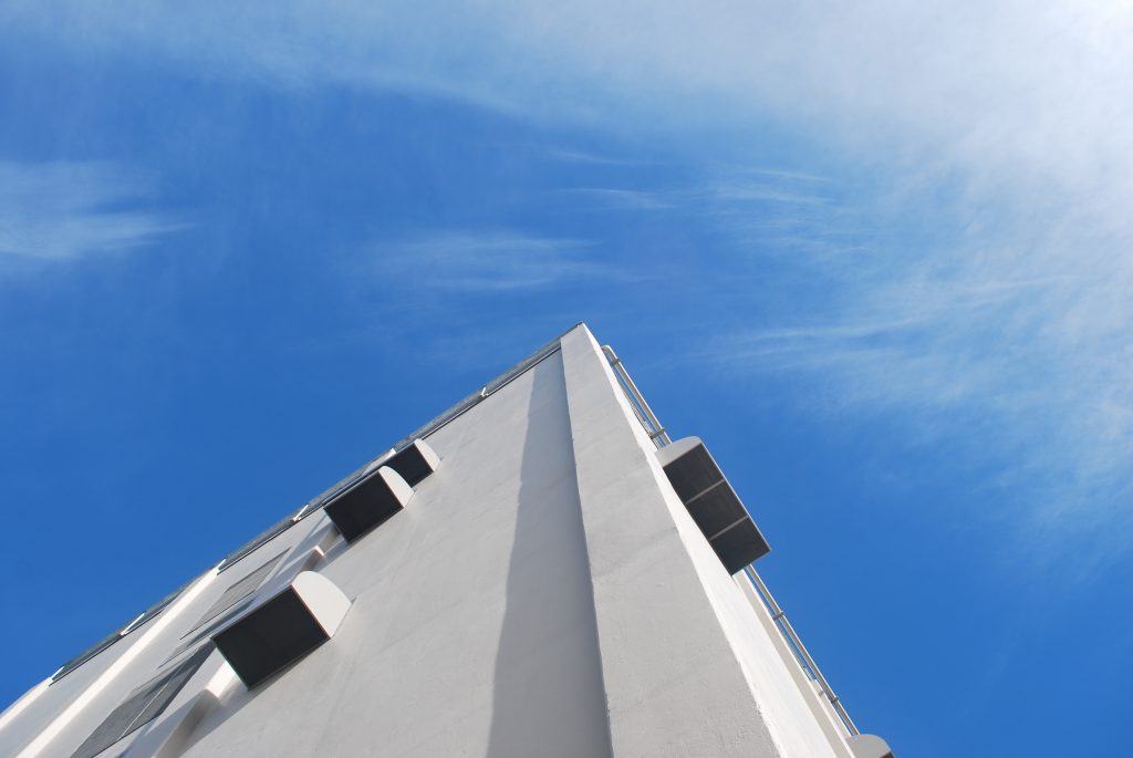
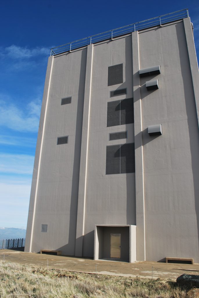
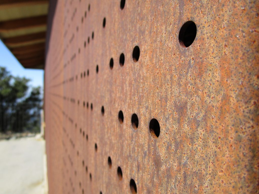
All cleaned up. Can not go inside still, but you can touch it now. It’s no longer behind all of the barrier fencing that had been up for quite a while. Same great views of the valley and a new paint job for the box.
Traveling around in #SanJose and #NearbyToSanJose at 825 mph on our spinning planet.
All cleaned up. Can not go inside still, but you can touch it now. It’s no longer behind all of the barrier fencing that had been up for quite a while. Same great views of the valley and a new paint job for the box.
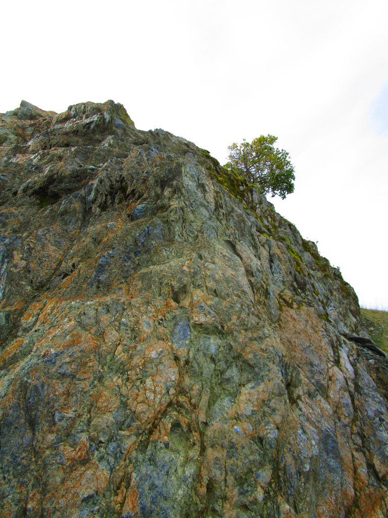
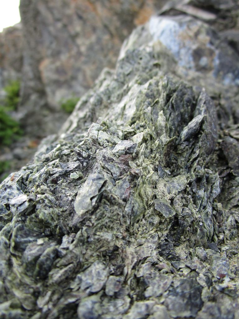
What happens when you start with mantle rock, that bendable hot semi-fluid-like rock that is miles below the surface and that the Earth’s crust floats on top of, and get it to come up a bit after mixing with ocean water and the heat induced chemical reactions that follow? You get a beautiful rock called serpentine that is usually miles deep but now makes up significant portions of the US west coast having been scraped off the ocean plates that sank below the US west coast in the last 200 million years.
A few interesting facts about this rock. It is awesome that it is the Earth’s mantle come up to the surface where we can touch it! It is the state rock of California. It can be mined for talc or asbestos. Did I mention it comes from miles below the surface? It is pretty. It is found where rocks from deep in, and below, the ocean have come to the surface through strong geologic events. The chemicals of the rock make it toxic to most plants and trees. Many California native plants have adapted to survive amongst the rock. You can see, for example, the Toyon bush (also known as California holly or Christmas berry) growing on the serpentine in the top photo.
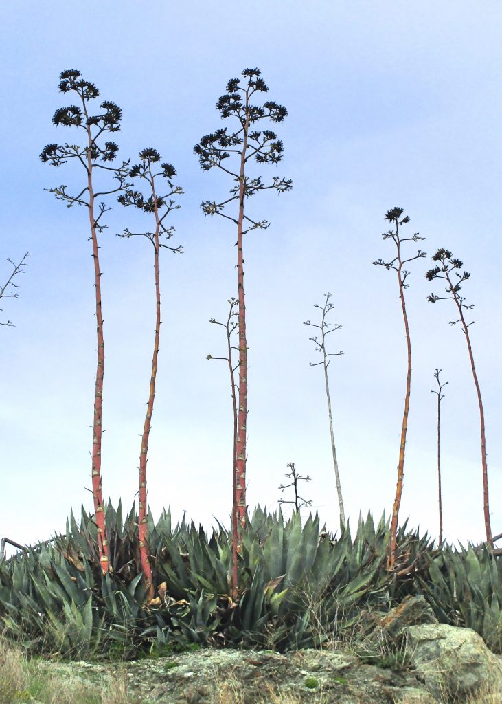
Knowing that most trees and plants can not grow on serpentine rock, a previous owner of this land, now a part of the Don Edwards Wildlife Refuge, planted agave plants to add some garden interest where he hoped to build a house. While the agave was not growing naturally in this particular area, it is one of the native plants that had adapted to grow among serpentine rocks in California. Today, in this national refuge, the planted agave continues to grow.
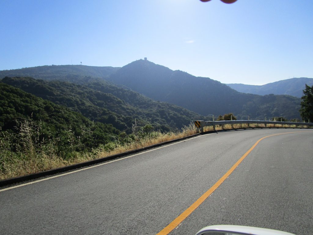
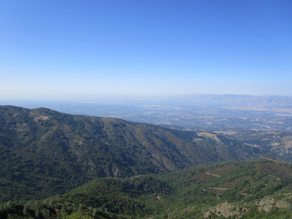
From just about everywhere in San Jose, there are a few orienting landmarks that can be seen. One of them is the square building, the box, atop Mt. Umunhum.
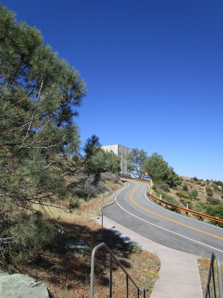
We listened to a fascinating app as we drove to the top. The app is designed for a self guided walking tour once there but it was perfect for us on the car drive as it lasted nearly the entire drive from our home, inspired us with thoughts of our destination, and gave us thoughts to consider as we explored the top.
Mt. Umunhum is a name that includes the root word for Hummingbird in all of the indigenous Ohlone dialects. The local natives named animals by the sounds that they made and Umunhum sounds like the moving wings of the hummingbird. And yes, I did see a hummingbird and butterflies; both of which apparently love this mountain top.
This was once Almaden Air Force Station, home to over one hundred military personnel and their families including many children. A small world complete with a bowling alley, pool, shops, and of course, the box that once held a state of the art long range radar dish atop it to detect aircraft from 250 miles away out over the ocean during the 60’s and 70’s until it was replaced by more advanced satellites. The one thing the station lacked was a school for the children who took a bus into San Jose each school day.
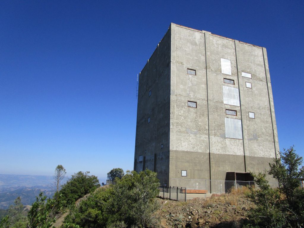
It was so interesting to see the box up close. I stared and argued with myself weather the box should be bigger or smaller in order to make it correct for the size it would appear after I drove the distance needed to get back home. That is, until I realized I had talked myself into a ridiculous conversation as I marveled at the structure and surroundings because obviously it was my perceptions that needed to be calibrated and not the size of the building to make all of the sizes and distances make sense with reality. It is often fun to run down mental rabbit holes.
Today, all of the buildings, except the iconic radar building, have been removed and work has been done, and continues, to restore the shape and vegetation of the mountain top. The renovations included bringing rock, previously pushed over the edges to build the station, back to the top and adding back 15 feet of altitude to the peak as it once had been.
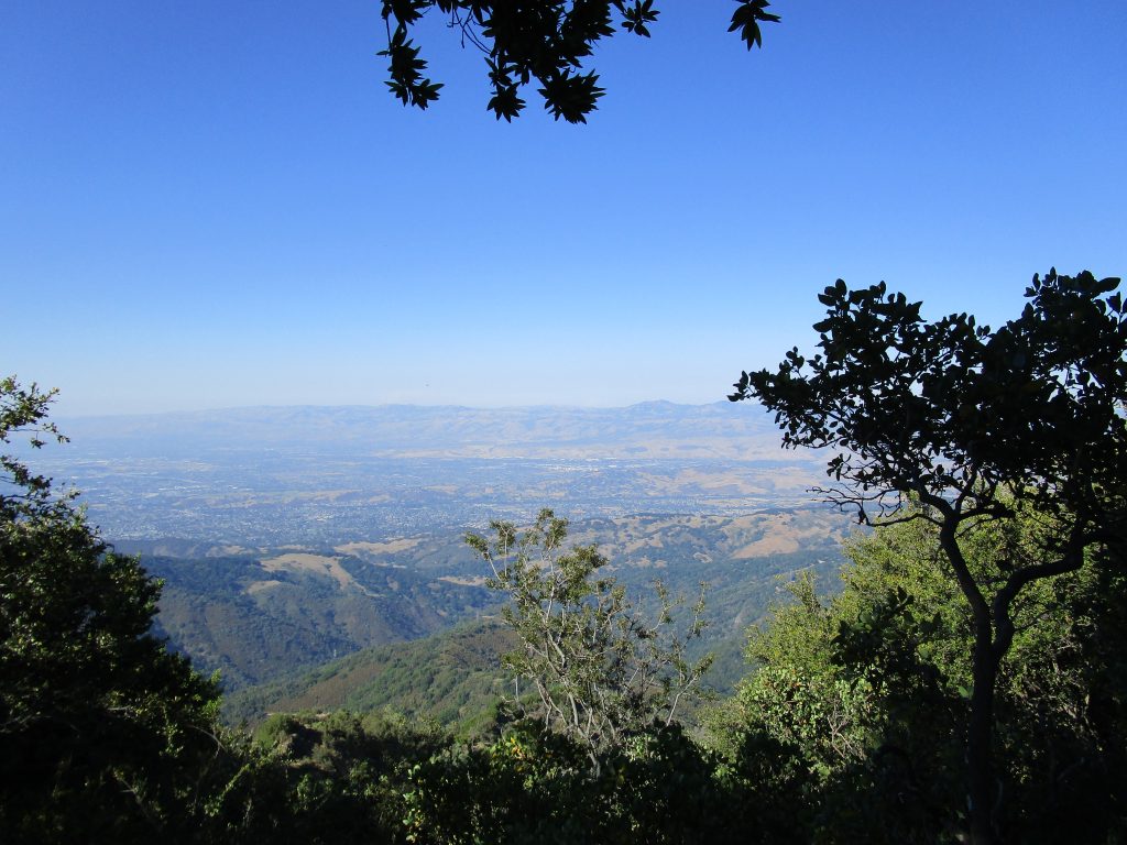
The views are, of course, incredible. It was a hazy day that we arrived and we could still see the San Francisco Bay as it reached San Jose, all of San Jose, the beaches of Santa Cruz at the ocean, Monterey across Monterey Bay, and so much more.
The descendants of the displaced native peoples of this land were consulted and asked that a prayer circle be built and opened to all of any faith to pray for ancestors and the future.
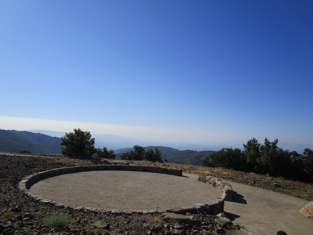
The prayer circle is opened to the east for native prayer rituals. The four directions are marked with iron. Using the iron marks as guides I found the exact middle to stand in. For no particular reason I did this and then I spoke, and… wow! My voice reverberated so beautifully. It was a shock and amazing. From the middle ones voice bounces harmonically off of the stone circle and comes back with a mellow and deepening vibration that was quite fun to play with. It reminded me of the childhood discovery of speaking into a fan. The excitement at the discovery and play at the effect only added to the pleasure of reflection from this beautiful point on the mountain.
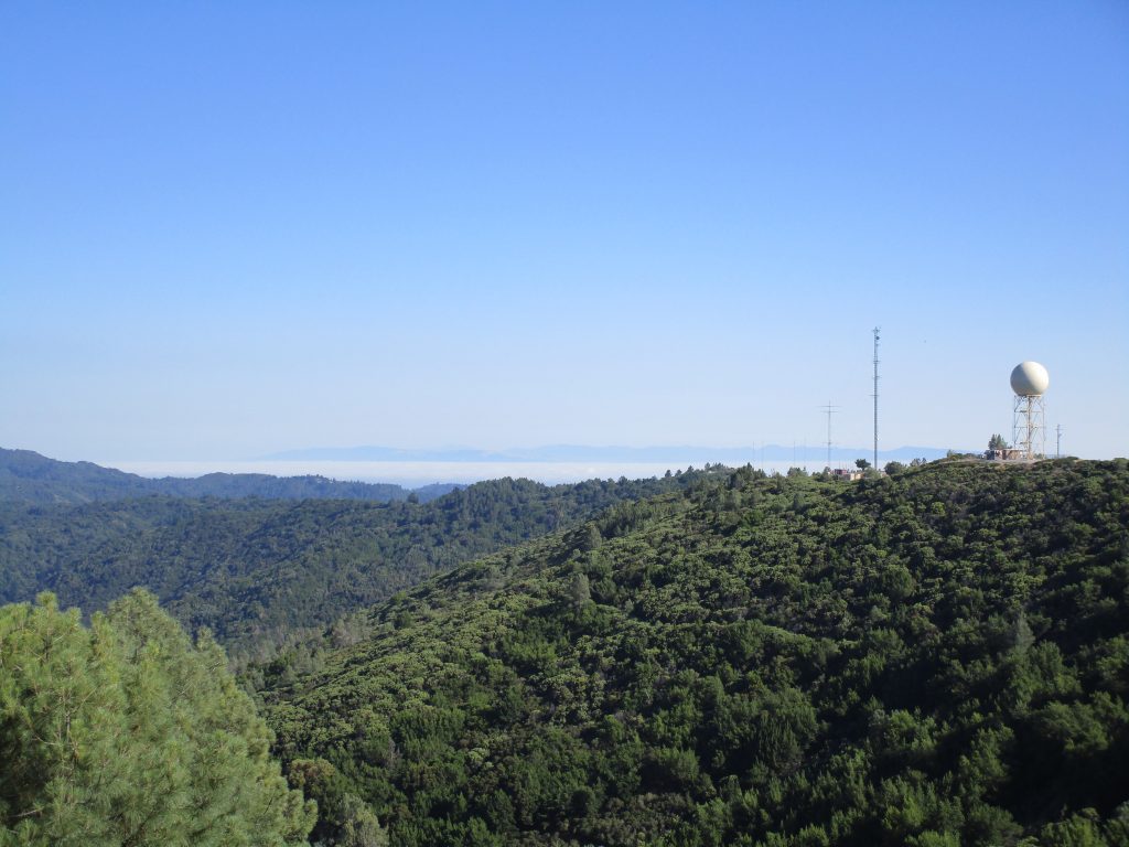
In the picture above, you can see the raised sphere nearby to the big box. The sphere is visible from some parts of San Jose depending on viewer’s location and weather. That sphere is a weather radar. When we watch the local news and see the green/yellow/red shapes moving in to indicate the degree of clouds and rain moving in to the bay, it is this radar and its siblings in the bay area that bring us those images.
The views, the perspective, the thoughts; these will bring me back to the top of Mt. Umunhum.