Third official boundaries of San José:
The first two boundary sets of San José occurred in the early years of the pueblo when it was first founded and then soon after when it moved a bit to avoid the flooding of the Guadalupe River.
The third set of boundaries were officially established in 1850 when the town of San José became an incorporated city soon after California had become a U.S.A. territory. California was applying for statehood that would be granted a few months later. Paraphrased from the Act of Incorporation in 1850, the city boundaries were from the east bank of Coyote Creek, two miles south of the center of Washington Square then due west to west bank of Guadalupe river, then following north to a point four miles in a straight line, then due east to Coyote Creek.
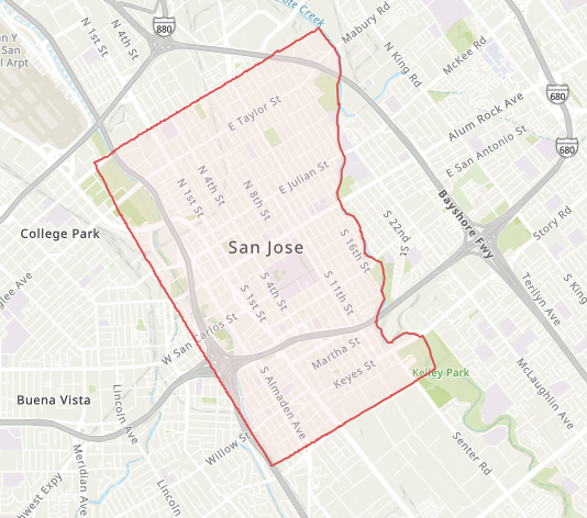
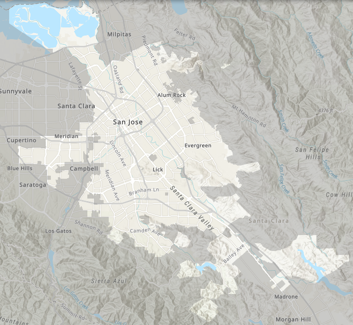
The map above shows the city boundaries when San José incorporated in 1850. It was approximately 5.5 square miles large, much larger than the original two San José pueblo boundary areas, both of which it encompassed. Compare that, however, to the city today in the map below. Spinning the words “San Jose” on the map below would just about cover the whole of the city boundaries as established in 1850. San José boundaries today have grown to the entire highlighted area in the map below. The city is now approximately 180 square miles large.
Sources: 1)Clyde Arbuckle’s history of San José, book by Clyde Arbuckle, 1986, page 27. 2)http://gis.sanjoseca.gov/apps/mapsgallery/ , 2019.